Showing posts with label Pistol River State Park. Show all posts
Friday, January 15, 2010
The Crazy Norwegian's and a Stormy Drive
Update: July 18, 2015. I visited The Crazy Norwegian's yesterday for the first time since this original post was written, since I've been living on the east coast in the interim. It pains me to say this, but I was thoroughly disappointed in the fish & chips, after lusting after them from afar for all these years. The batter was thin, not very dark, rather tasteless, not crisp and fell off the fish. Totally different from my previous experiences here. An anomoly? I don't have a clue. The place was packed with a waiting line by 5pm nevertheless, and I expect much of the menu is still delicious. But personally, I wouldn't recommend the fish & chips any longer. Sadly!
Some of the best fish & chips I've ever had are to be found at a funky little place in Port Orford called The Crazy Norwegian's. Since I plan to be moving from Oregon soon, I've been itching to get up there for one last feast before I leave. I also wanted to go with the friend who led me to this place, and we've been waiting for a sunny day, in the hopes of getting some decent photos off the coast on the drive north. We've had sunny days, but this time of year, in the off season, the restaurant is only open Thursday through Sunday and apparently, the sunny days haven't coincided with those days. It's been hard to coordinate.
No sunny weather today, either, despite a promising forecast. Gray, dreary, super windy. But, I wasn't disappointed once I arrived at the destination. Tender cod, crisp breading, tangy cole slaw, and an atmosphere that's hard to describe. You'll just need to see it for yourself. They have lots more on the menu, but I personally have never made it past the fish & chips.
Yes, a gray and dreary day all around, but the inside was cheery and the food wonderful.
We dawdled a good bit driving north -- not the best day for photography, but we couldn't help ourselves. These birds -- seagulls and pelicans -- were massed by the hundreds on these piers in Gold Beach and flying in swarms above.
Not pretty critters, but interesting. Neither of us had ever noticed the red and yellow on these guys before, nor so many of them clustered together in one spot.
We also stopped at Pistol River, just south of Gold Beach, to watch the huge waves that were crashing into all the rocks. I can't blame these black and white photos on some nefarious activity of my camera. There was simply no color out there. Dreary, dreary, dreary. The wind was so strong, I could barely stay balanced well enough to get these photos with the telephoto. If the resolution isn't all that great when enlarged, that's the reason why.
These three are all the same rock with wave after wave crashing onto it. There were lots of waves and lots of rocks, but this one seemed to be putting on the best show consistently.
Since I tend to be a lazy photographer and let the camera run on automatic, I can't set the shutter speed and thus don't get that lovely, crisp water-stopping effect, but still, I like the movement.
Sunday, November 29, 2009
Sisters Rocks State Park -- and a Nice Sunset
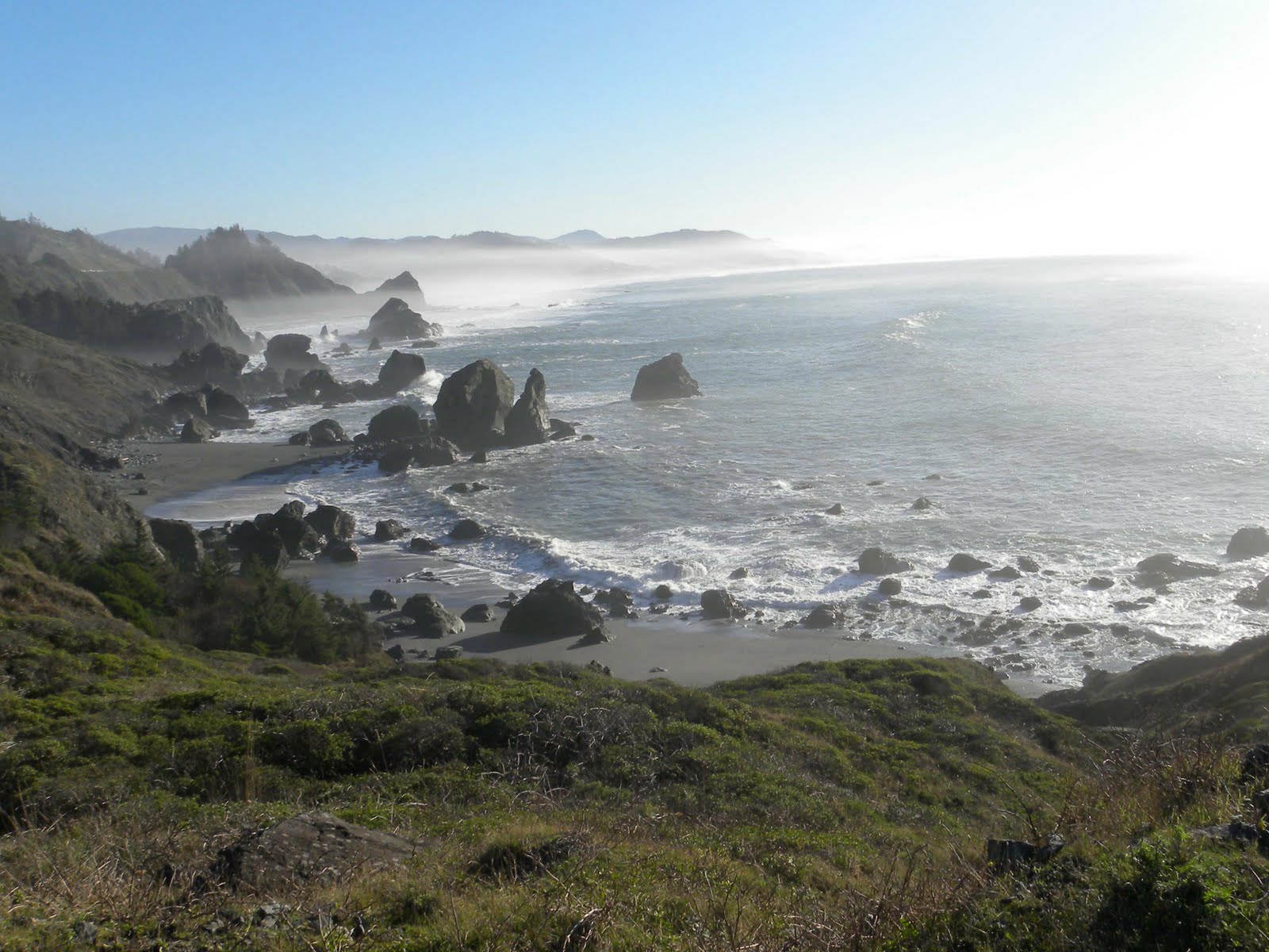
The quest was for a secret sea cave, which William Sullivan wrote about in an article in the Eugene Register-Guard On June 29. We never found that, but the spot was spectacular and we really didn't mind, although the mist did adversely affect the clarity of the photography. Frankly, to me it was one of those places that is so spectacular you really can't capture it with a camera, anyway. But I tried. Somehow, probably because I was so captured by this one vista, I didn't get any photos of the three large sea stacks that lie at the end of the road, and where the sea cave is supposed to be.
There is no sign on the highway, other than a standard Oregon State Parks sign with no name. About 13 miles south of Port Orford, and about 14 miles north of Gold Beach, between mileposts 314 and 315, an old rocky side road turns to the west beside a bluff. Sullivan advises parking your car immediately, and I have to agree, but we were in a pickup with high ground clearance so we followed the rutted road a short distance to a locked metal gate. Trust me, there is absolutely nothing on the highway that indicates any reason to pull off the highway here. We had serious doubts we were in the right place, but it was the only possibility between those mileposts so we gave it a try. A short walk down the road leads to the above vistas plus more to the north all the way to Humbug Mountain and three giant sea stacks from which the park takes its name.

Earlier, we'd scouted a location for some sunset photography and arrived at Pistol River State Park just in time to watch the day come to a glorious close.
Monday, June 8, 2009
Pistol River via Carpenterville Road
I've been curious about Carpenterville Road -- also known as the Old Oregon Coast Highway -- since I've been here, and since I needed to visit the recycling center on that road this morning, I decided to follow and see where it went. I knew it ended up at the highway once more further north, but where did it go in the meantime? It's a nice, two-lane winding road with decent grades at each end -- but in the middle, it follows a high ridge that drops away on both sides to spectacular views, when I could catch glimpses through the trees. To the west, of course, lay rolling hills and the distant ocean; to the east, a very large valley gave way to larger mountains in the distance.
Wild azalea, rhodies and foxglove blossomed abundantly along the highway and I never saw a settlement that might have been Carpenterville, although it shows on maps. According to Oregon Geographic Names, a wonderful tome of a book given to me recently by a friend, the name comes from a family that settled in the area in 1921 and ran a small sawmill, among other things. When the highway was built, the family opened a store and tourist cabins and in 1932, a post office was established and named for the family, but closed in 1944. I saw houses here and there, old and new, but don't know which might have once been the town. No photos, because the road was narrow and there were few places to stop -- and really, nothing to photograph other than trees and ferns and wildflowers -- which is not all bad.
Once I returned to the highway, about 17 miles north of Brookings, I drove on a short distance to Pistol River State Park and the four-mile-long sandy beach that connects it to Cape Sebastian to the north. I thought surely the name Pistol River must have a great story behind it. Apparently not. According to my book, a certain James Mace lost a pistol in the stream in 1853 and it's been called Pistol River since that time.
The morning clouds were just lifting, the tide coming in gently as I waded barefoot along (and sometimes in) the water's edge. This view is looking north, with Cape Sebastian in the distance. One of these days I need to explore the Cape, as there are apparently spectacular views from there.
Looking south, with lingering mists and foamy surf. This is the longest stretch of walkable beach in the south coast area, and certainly one of the most accessible. Pistol River State Park also features long stretches of sand dunes, which are fun to scramble up and down. Nothing like the Oregon Dunes further north, but fun nonetheless. This is a small one.... I really didn't go into the dunes this morning, as the surf called to me. Another time.

These huge beach rocks fascinate me -- such stories they could tell, if only they could speak! Look at all these colors....
They're also pretty darned spectacular to watch as the tide swirls in around them.
Wild azalea, rhodies and foxglove blossomed abundantly along the highway and I never saw a settlement that might have been Carpenterville, although it shows on maps. According to Oregon Geographic Names, a wonderful tome of a book given to me recently by a friend, the name comes from a family that settled in the area in 1921 and ran a small sawmill, among other things. When the highway was built, the family opened a store and tourist cabins and in 1932, a post office was established and named for the family, but closed in 1944. I saw houses here and there, old and new, but don't know which might have once been the town. No photos, because the road was narrow and there were few places to stop -- and really, nothing to photograph other than trees and ferns and wildflowers -- which is not all bad.
Once I returned to the highway, about 17 miles north of Brookings, I drove on a short distance to Pistol River State Park and the four-mile-long sandy beach that connects it to Cape Sebastian to the north. I thought surely the name Pistol River must have a great story behind it. Apparently not. According to my book, a certain James Mace lost a pistol in the stream in 1853 and it's been called Pistol River since that time.
The morning clouds were just lifting, the tide coming in gently as I waded barefoot along (and sometimes in) the water's edge. This view is looking north, with Cape Sebastian in the distance. One of these days I need to explore the Cape, as there are apparently spectacular views from there.
Looking south, with lingering mists and foamy surf. This is the longest stretch of walkable beach in the south coast area, and certainly one of the most accessible. Pistol River State Park also features long stretches of sand dunes, which are fun to scramble up and down. Nothing like the Oregon Dunes further north, but fun nonetheless. This is a small one.... I really didn't go into the dunes this morning, as the surf called to me. Another time.
These huge beach rocks fascinate me -- such stories they could tell, if only they could speak! Look at all these colors....
They're also pretty darned spectacular to watch as the tide swirls in around them.
Subscribe to:
Posts (Atom)